Gea bike route
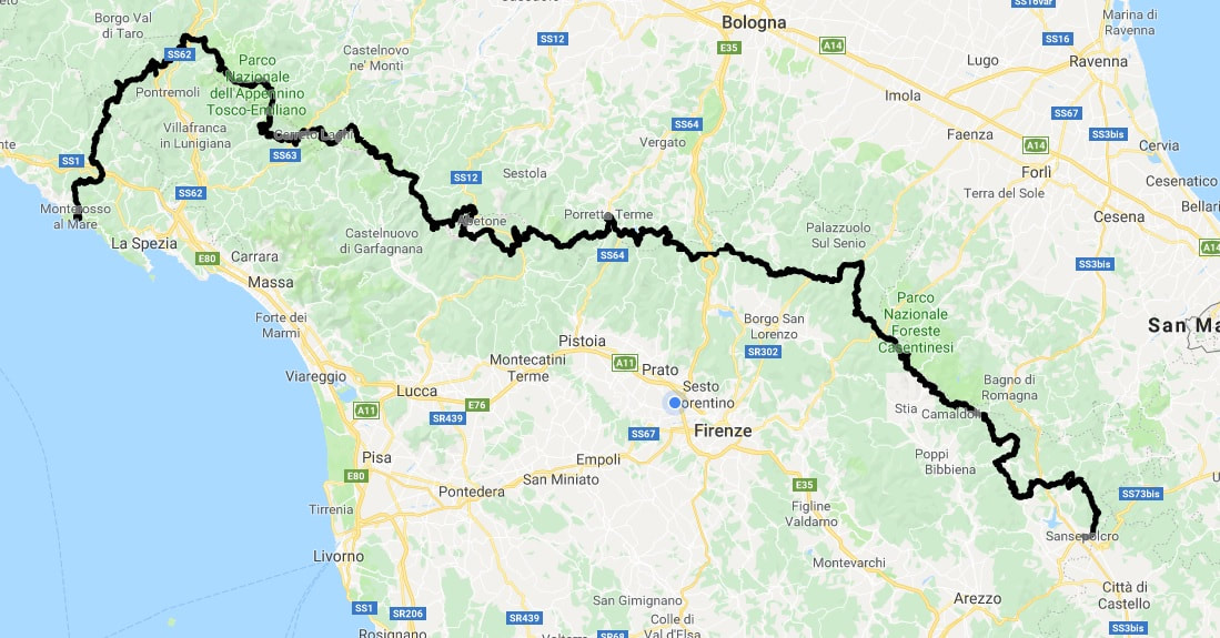
Starting from Arezzo to the Due Santi pass, Zum Zeri village, close to the Ligurian border, finishing in Monterosso al mare, 5 Terre.
600 km, 22.000 meters of elevation.
37 passes, following the skyline of mountains between 700 and 1900 m height.
Starting from the hills close to Arezzo, through the Casentino national park forests, across the peaks of Mugello and Pistoia mountains, and finally to the Apuane alps.
The Apennine area is one of the wildest areas in Italy.
Apennine villages are nice places to rest after the ride, to have dinner in a family restaurant and to sleep in a comfortable B&B. You will find them in every little village.
The trail path is pretty tough in places, and riders will occasionally have to push or carry their bike for short distances. Roads will make up just 10% of the route.
On the route you will find many water sources and food shops.
You will need to be rational in order to finish the trail, buying enough food and resting when you need.
Completing the GEA Bike Trail will not be easy but it will be a great victory for every rider who takes up the challenge. There are no prizes, the landscape and the satisfaction of completing the GEA Bike Trail will be your reward.
The route follows the original GEA path as much as possible, leaving it when the original path is too hard to be ridden by bike.
90 % of GEA Bike Trail is on mountain trails, between 700 and 2200 m height.
We have kept the original stage points, where you will find water, food and rest.
Sansepolcro is the starting point, a small town that you can reach by car or by train and bus or bicycle.
The finish line is in Monterosso al Mare (SP),
The GPS route may be modified due to trail conditions and weather in the coming months.
All riders will receive the official GPS route prior to starting.